
Thursday Weather Update and update on potential for heavy rain on Friday
Hi everyone! This has been a crazy day for me with tracking the weather models and keeping up with what to forecast for the rest of today and the amount of rainfall we could see on Friday.
Let's start with the remainder of today.
We are in a bit of a break now for precipitation however, I would not be surprised with this northeast flow of the precipitation to see a few more isolated showers move through the county during the afternoon hours.
Below is a timeline of when showers and some moderate rainfall could move through the county.
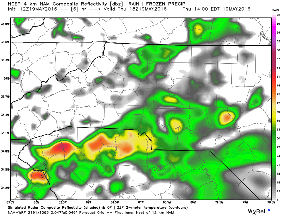
I expect more isolated showers will move into the county around the 2pm timeframe. This showers will be tracking to the northeast.
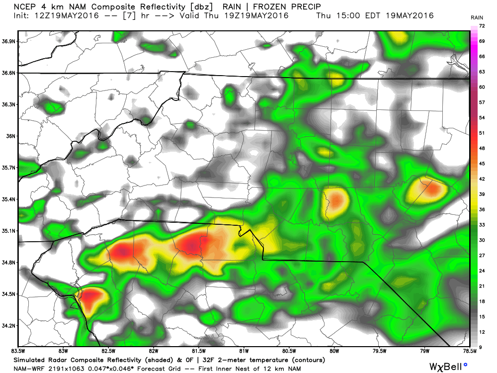
Showers will continue to be isolated and shift off to the northeast as we head into the hours of the afternoon with school dismissal traffic being impacted
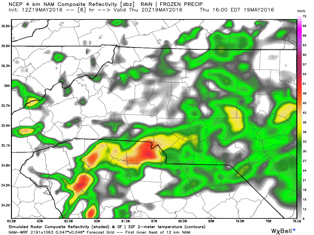
As we head into the late afternoon and evening commute hours we will start to see some rain moving off to our east and remain to our south.
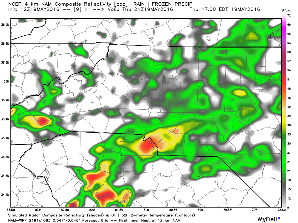
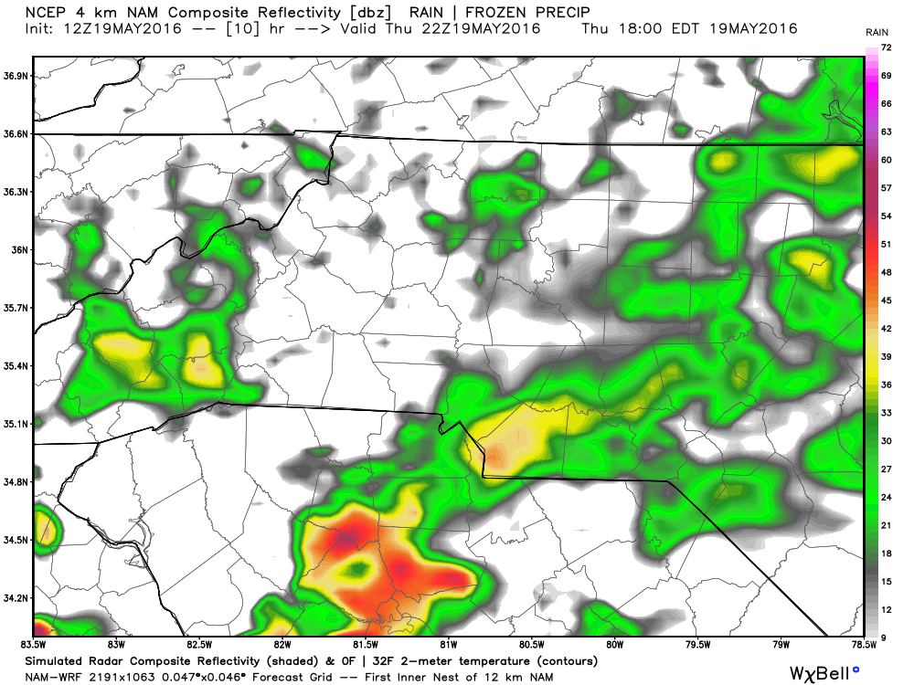
By the early evening hours we should start to dry out with a slim chance of isolated showers in the evening.
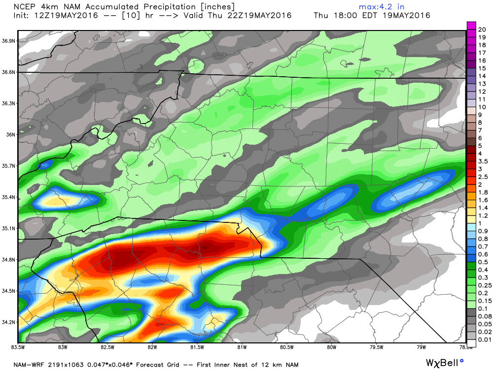
The additional amounts of rainfall on top of what we already have will be around a quarter of an inch is some areas.
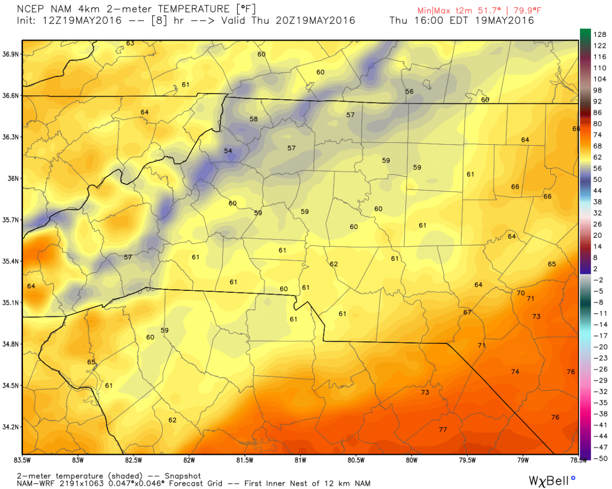
The temperatures will not move much as we hover around 60º for the high.
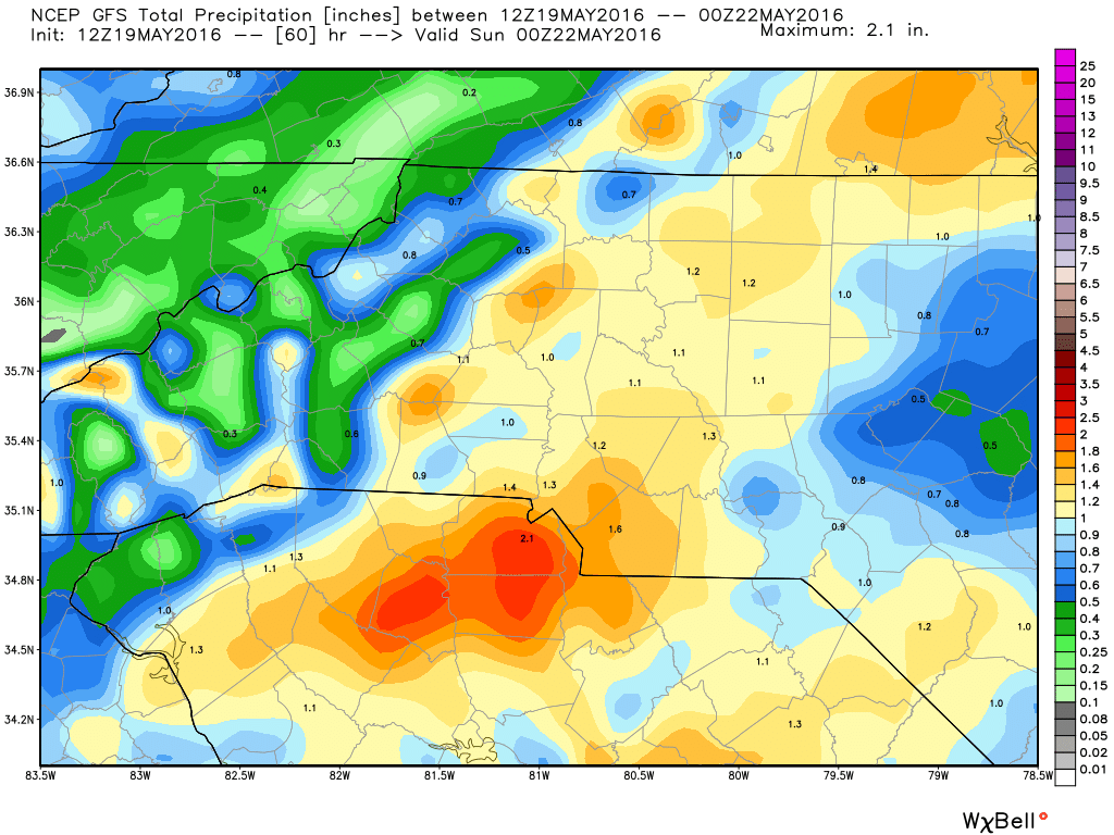
I know the question that is in the back of some of your minds is what about activities involving the NASCAR Race? Friday night activities at the track are probably in the most jeopardy at this point. I do believe the rain will move out during the morning hours and midday hours on Saturday. Looking at around an inch or more of rain from Friday night to Saturday afternoon.
I will continue to post updates as the information comes in. Stay dry everyone! As always thank you for following Rowan County Weather!