
More storms with hail coming tonight
Wow! What a crazy afternoon already. Well, I reported in a post earlier about storms tonight that I was concerned with. That concern is still there. Expect much more of what you saw this afternoon to move through late this evening between 8 & midnight. Lightning heavy downpours and hail will be the main concerns. There is a Severe Thunderstorm Watch in effect until 10pm it is possible that could get extended.
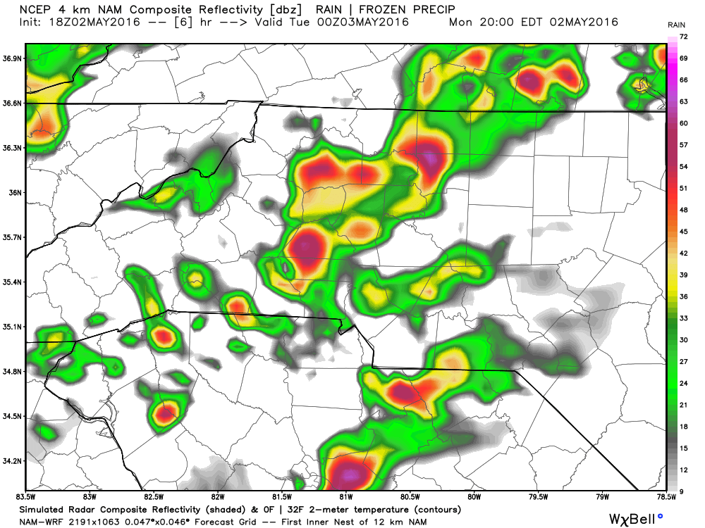
Looking at the latest model information it is possible we will see some strong to severe storms move into the county around or just after 8 pm.
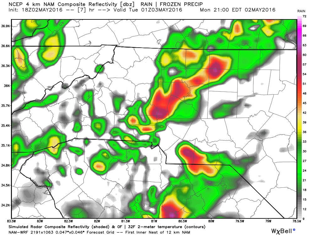
As these storms continue to move through the county a chance for another round of hail increases as the atmosphere is pretty unstable right now and these storms are getting some decent updrafts.
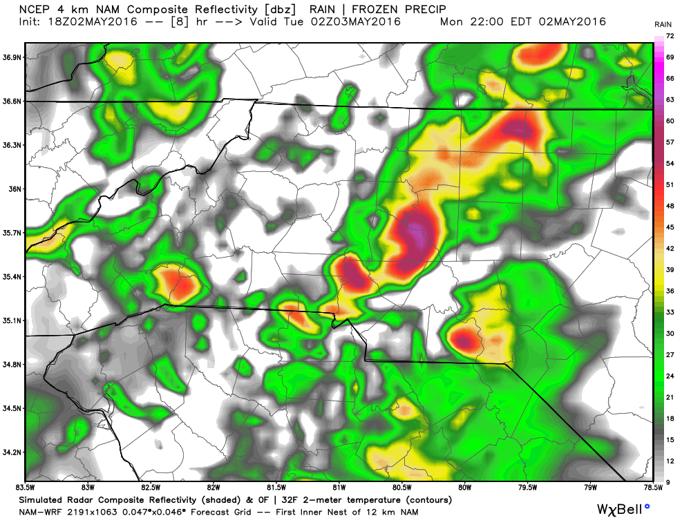
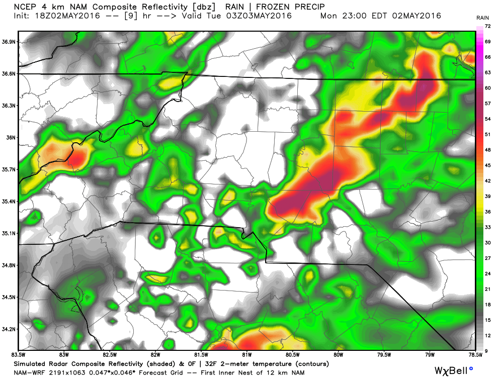
These storms look to be around late into the evening and possibly into the overnight hours as we head into Tuesday.
If you happen to be in the path of one of these storms make sure you are inside and plan on the possibility of power outages so charge those cell phones, tablets, laptops and flashlights. Just so you have a way to stay informed.
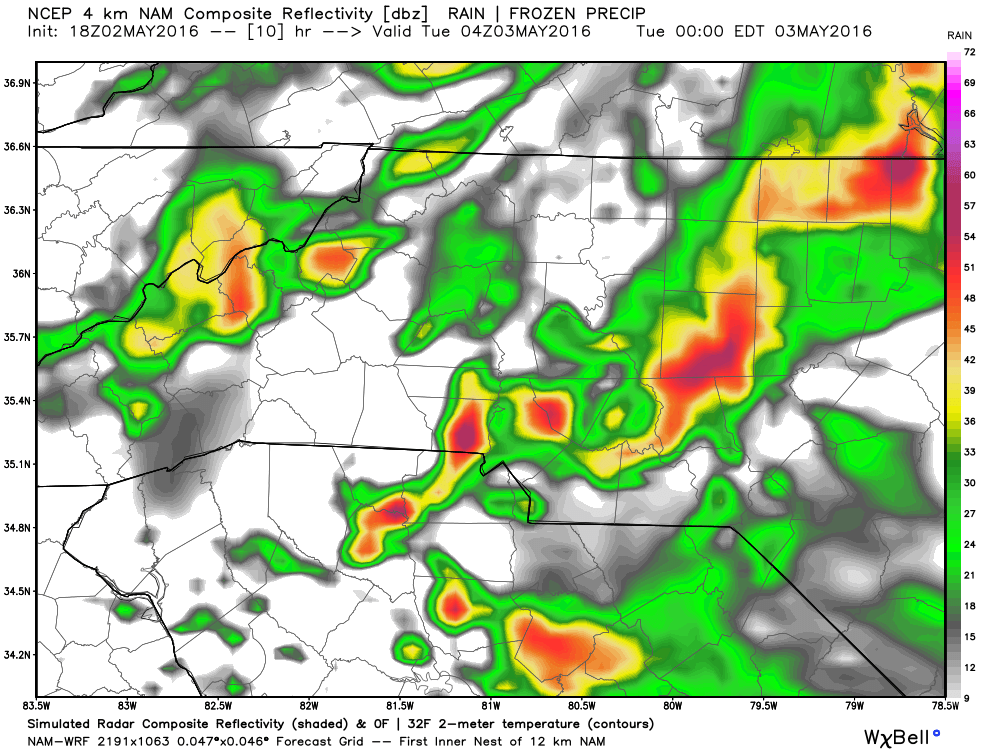
I do expect as we start to head into the overnight and early morning hours of Tuesday that these storms will weaken and the severe threat will diminish quickly.
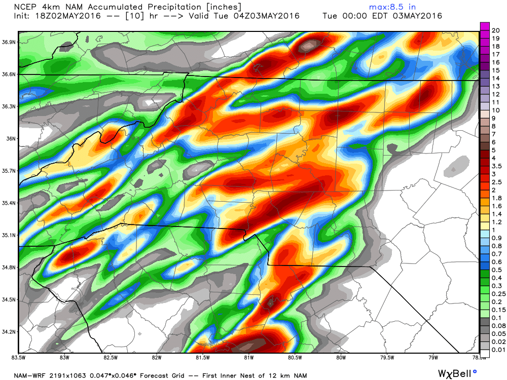
The total accumulation possibilities are pretty high and again I have to stress that these totals get inflated when the chance for hail is involved. Models can't distinguish between solid and liquid precipitation. The possibility of hail always makes the total accumulation chances go up. I expect that we could see another quarter to a half of an inch of rainfall accumulation and small hail is possible as well.
I will continue to keep you updated throughout the evening right here on the website and on social media. As always thank you for following Rowan County Weather!