
Sunday Morning Weather Update
As we are now closing in on midway through the morning hours of the daytime this Sunday. I wanted to take a few moments to get you ready for what to expect this afternoon and evening so you can plan out your day.
First of all things are overcast for now but I think we could see a few breaks in the clouds later today that may give us a few moments with the sun today.

That is also a bit of bad news. The atmosphere is already a bit unstable so this could generate a few evening and late night isolated thunderstorms that could move through the county between 6 and 10 pm tonight.

There is a chance we could see some isolated showers and thunderstorms that could generate from any sunlight that we see throughout the day today.
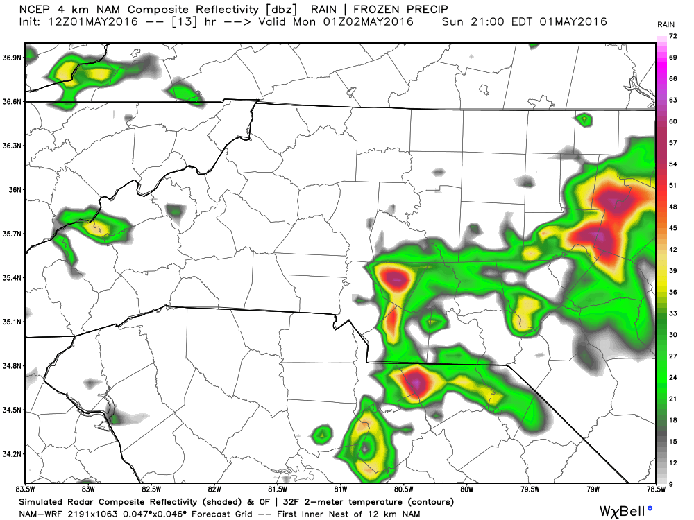
There is a chance that a few of these storms could contain some small hail inside of them as well.
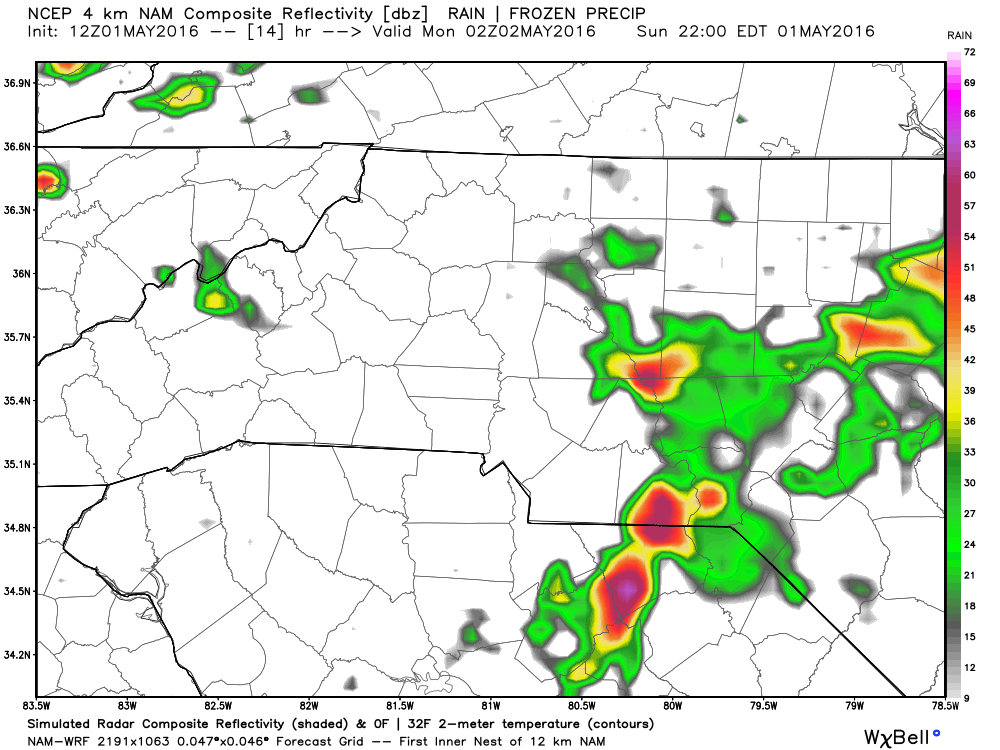
I do think that by around 10 pm we will see most of the isolated shower and storm activity shift off to our east and we will start to see some clearing for the overnight hours.

We have already gotten some great precipitation totals since midnight to eat into the deficit for the year. I expect with a few more isolated showers and storms later tonight we could pick up an addition half an inch to an inch of rain in some areas of the county.
I will post another update here and on social media later today to give you one final heads up as we head into the evening hours. As always thank you for following Rowan County Weather!