
Drizzle now but showers and storms are coming
If you have been outside any this Saturday you have obviously felt the persistent pesky drizzle that falling. Later tonight that drizzle will turn into rain and bring the possibility of thunderstorms with it.
Let's take a look at the timeline and how you can plan around it. First and foremost drizzle will be around pretty much all day before the heavier rain moves in around 7 pm tonight.
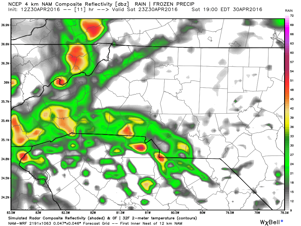
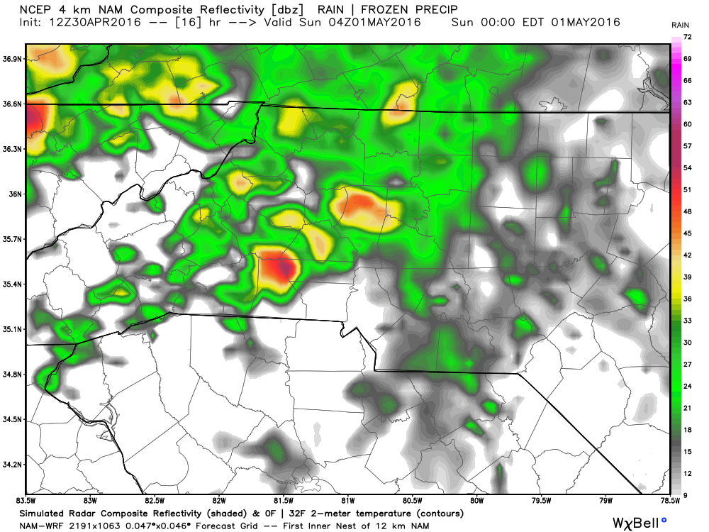
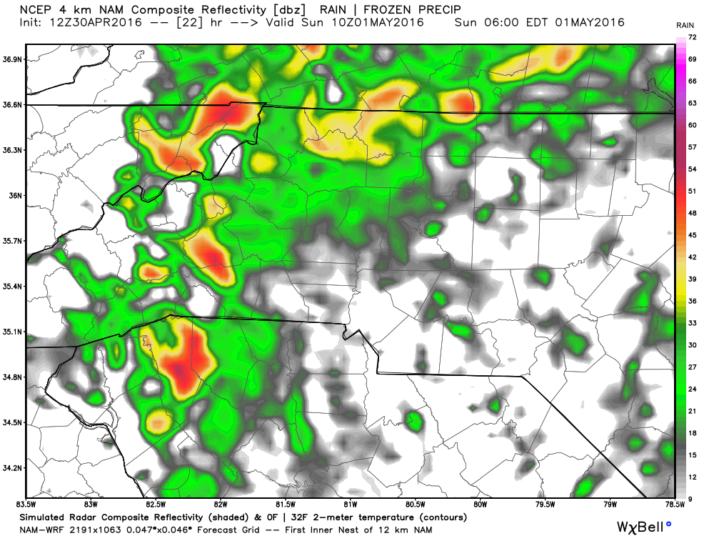
As you can see the rain should be just to our southwest around 7pm but again I would not be surprised if you are still dealing with drizzle around that time.
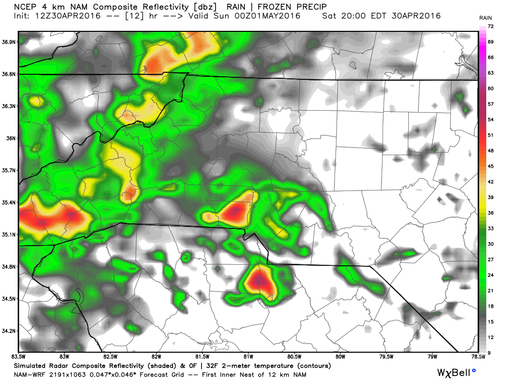
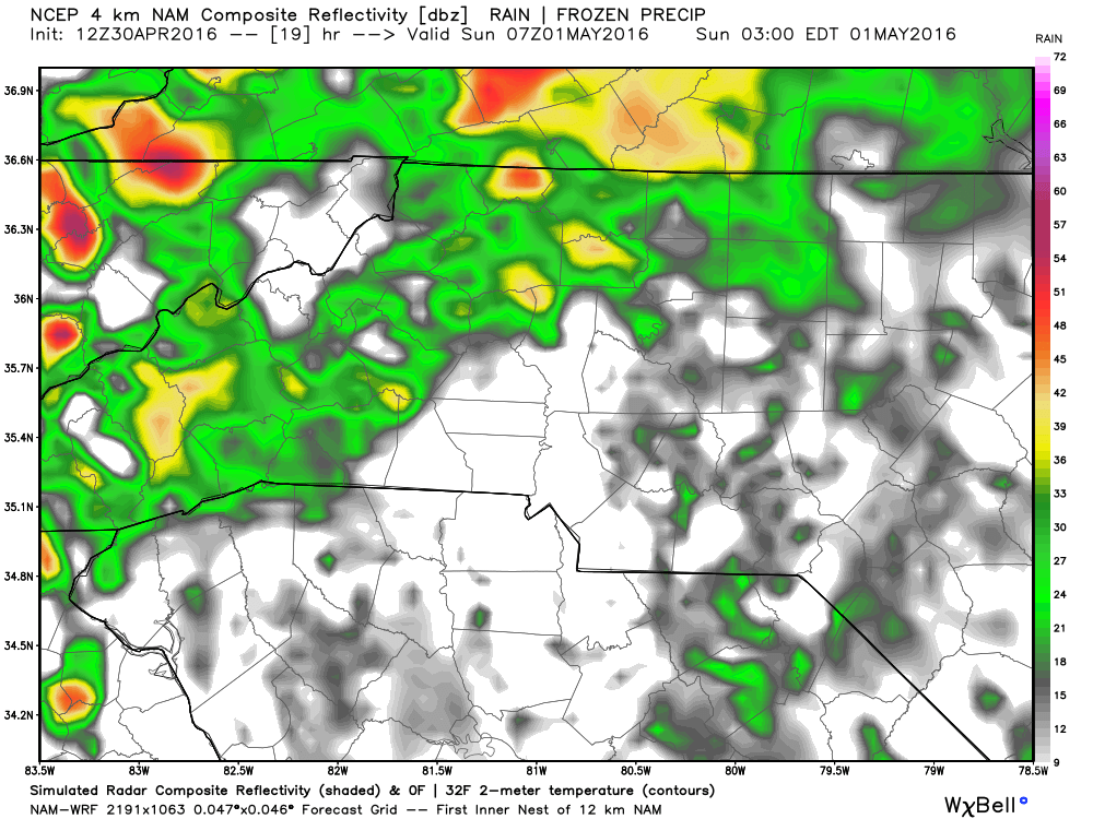
The rain should begin to move into the western portions of the county between the hours of 7 & 8 pm tonight and once it starts looks to continue off and on through the day on Sunday.
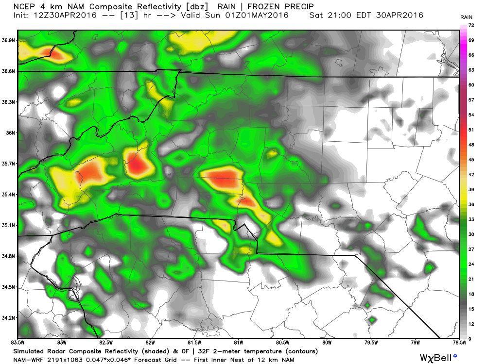

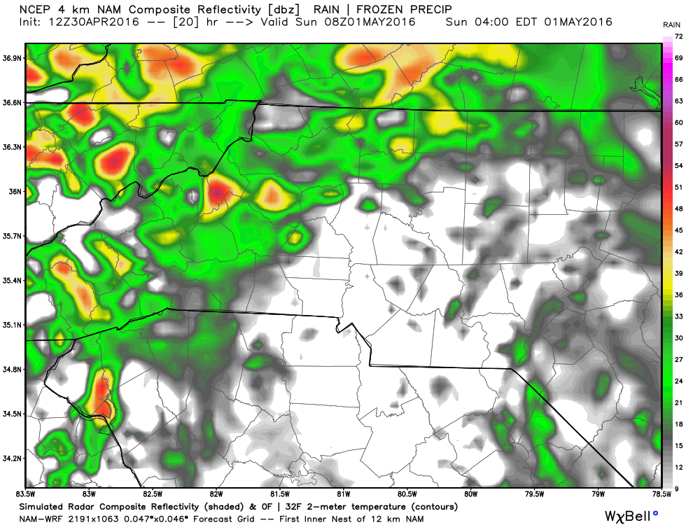
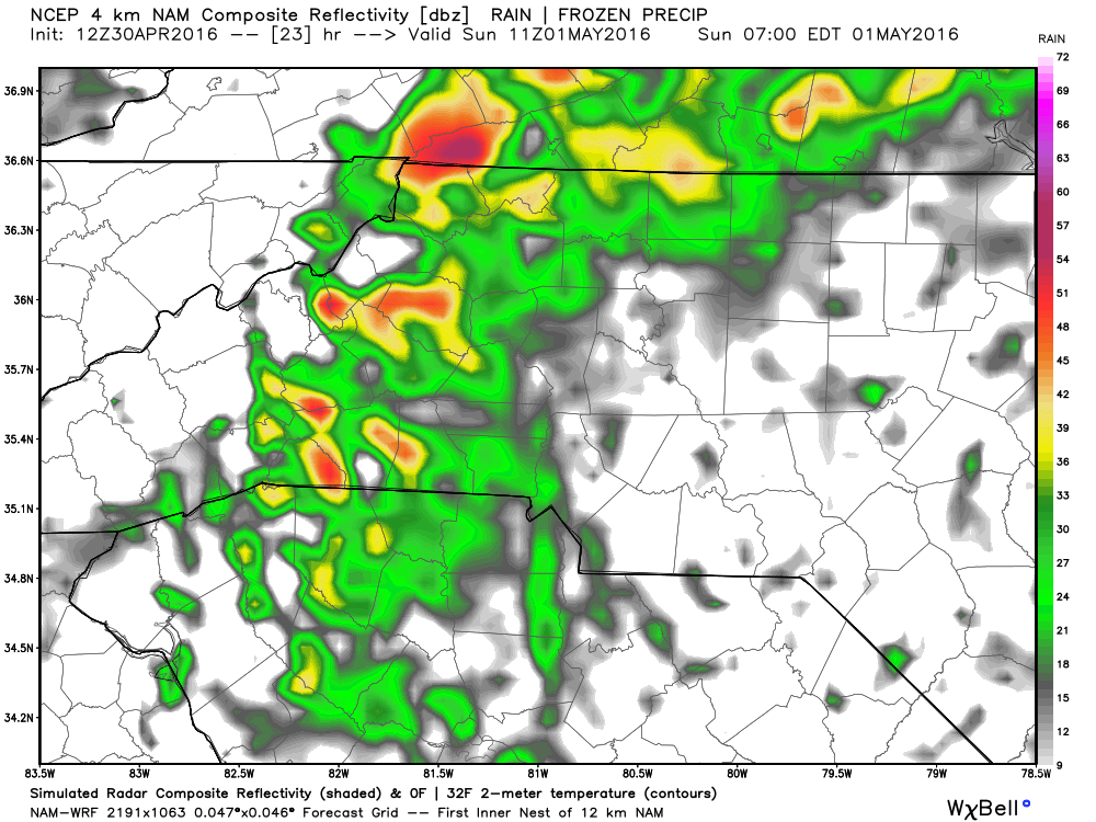
During the late evening hours is when we could see some thunderstorm activity try to get in the mix. Not expecting anything severe at this point but I will certainly keep an eye on it.
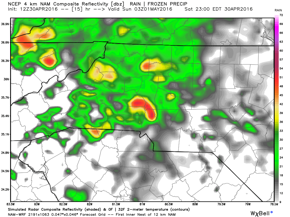


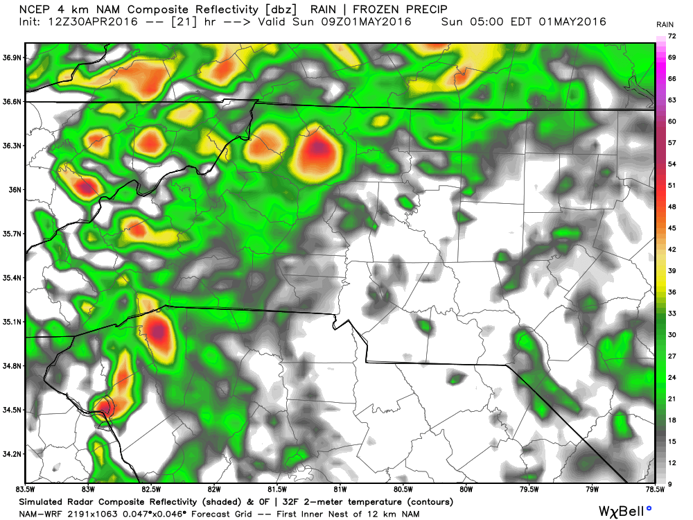
We could see some clearing from the heavy rain transition over to drizzle during the overnight and early morning hours of Sunday. Don't let this fool you though there will still be periods of heavy rain and storms throughout the day on Sunday.

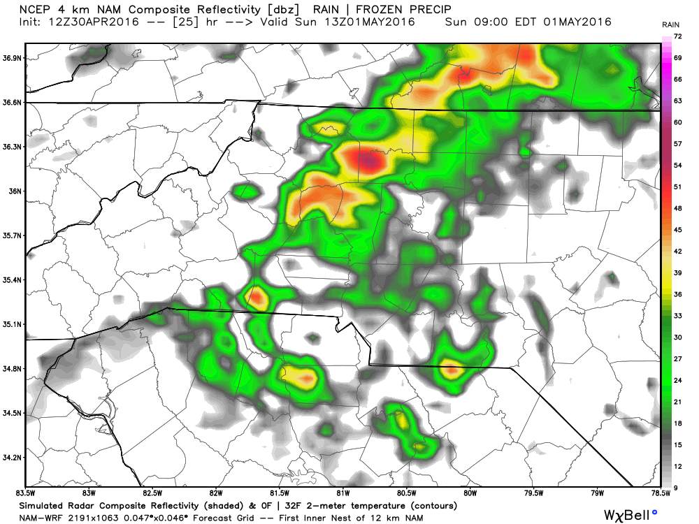
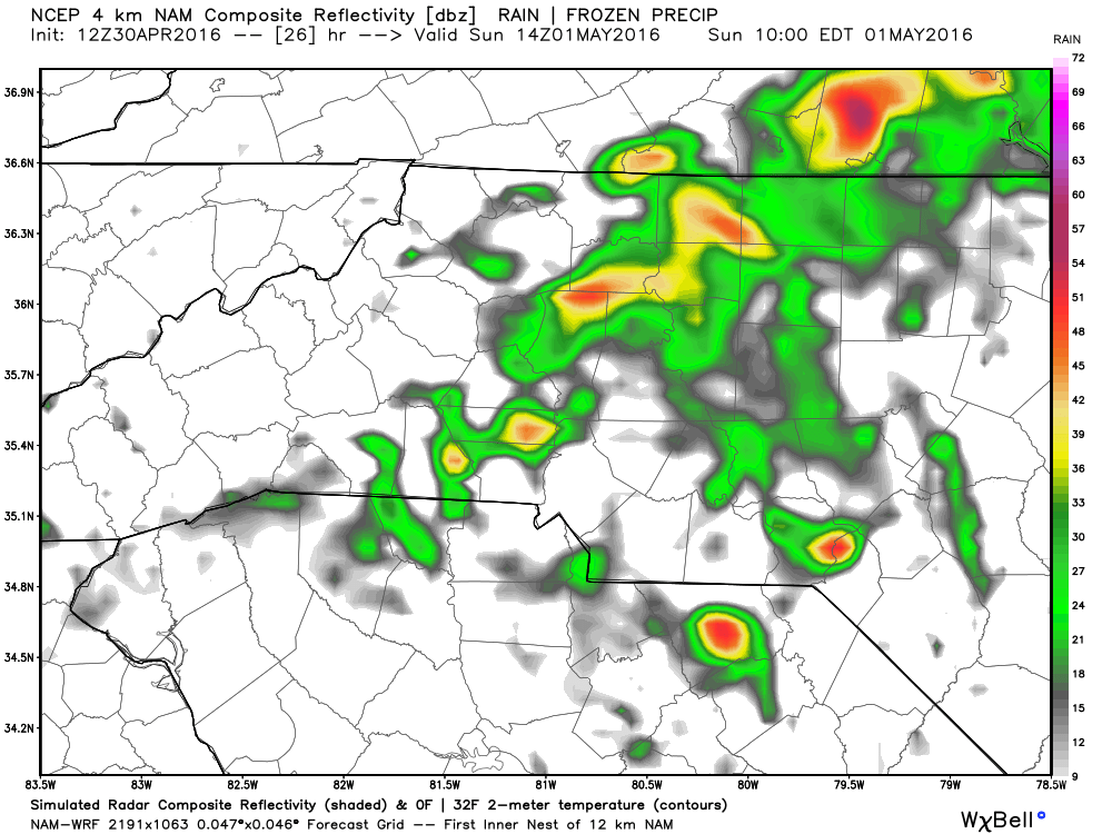
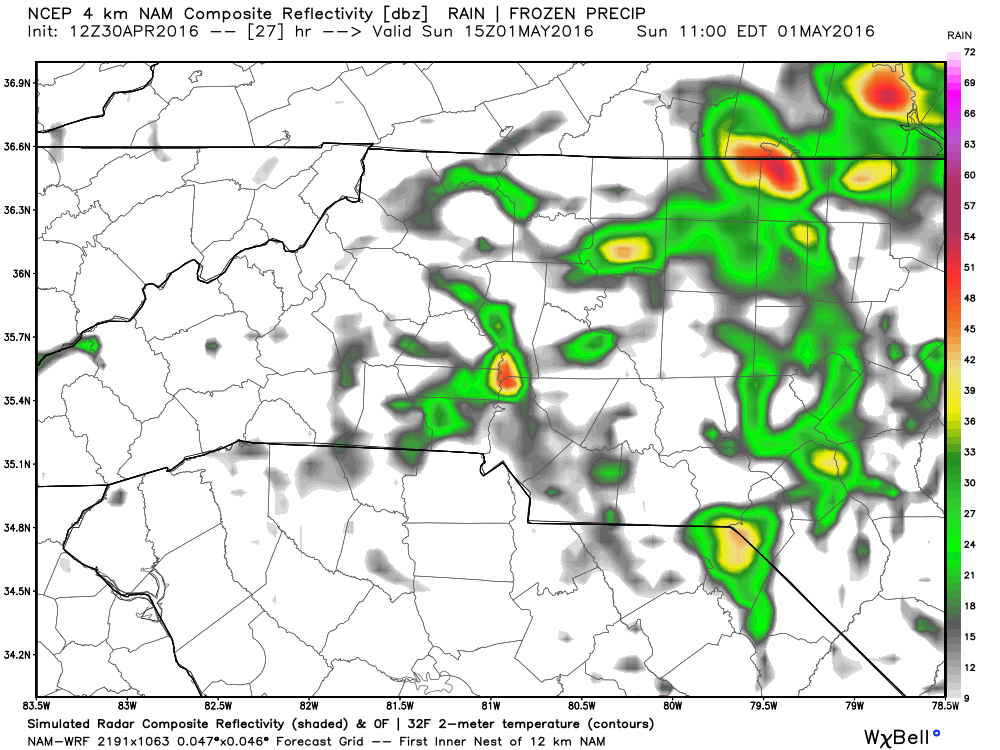

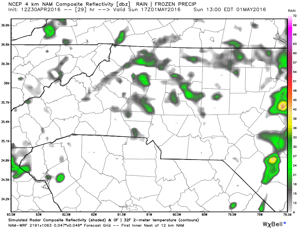
As you can see it's going to be a much needed wet 24-36 hours as we progress through the weekend. Rainfall is expected to continue off an on through the early morning hours on Monday. Then we get into the typical spring pattern of popup afternoon thunderstorms. As far as precipitation goes over the next 30 or so hours.

It is possible that areas around the county will see anywhere from a quarter of an inch to over an inch of rain. I will continue to post updates throughout the weekend on how things are trending right here and of course on social media as well. As always thank you for following Rowan County Weather!