
Rain Chances creeping back up for Friday
The latest model runs are trending toward a better chance for at least some accumulation of rainfall for tomorrow. Now keep in mind this is only one model run as most leading into this event have trended down showing not much opportunity for rain. However let's take a look at what COULD happen based on this latest model run.
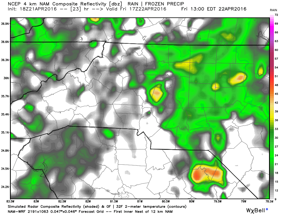
It looks as if we will have Some light rain or even drizzle around during the 8 am hour tomorrow as most of us are heading out to work and school. I am not buying to much into anything above light rain at this point in the day tomorrow.

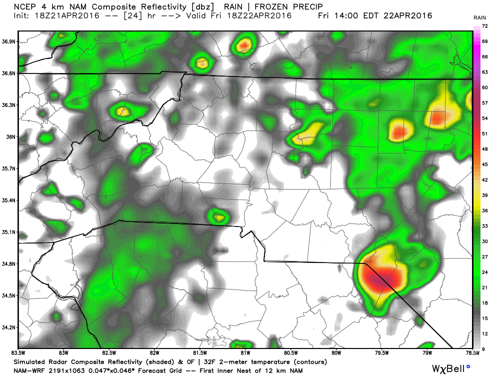
I think that light rain and drizzle will stick around most of the morning. The slides over the morning hours below will show that trend continue.


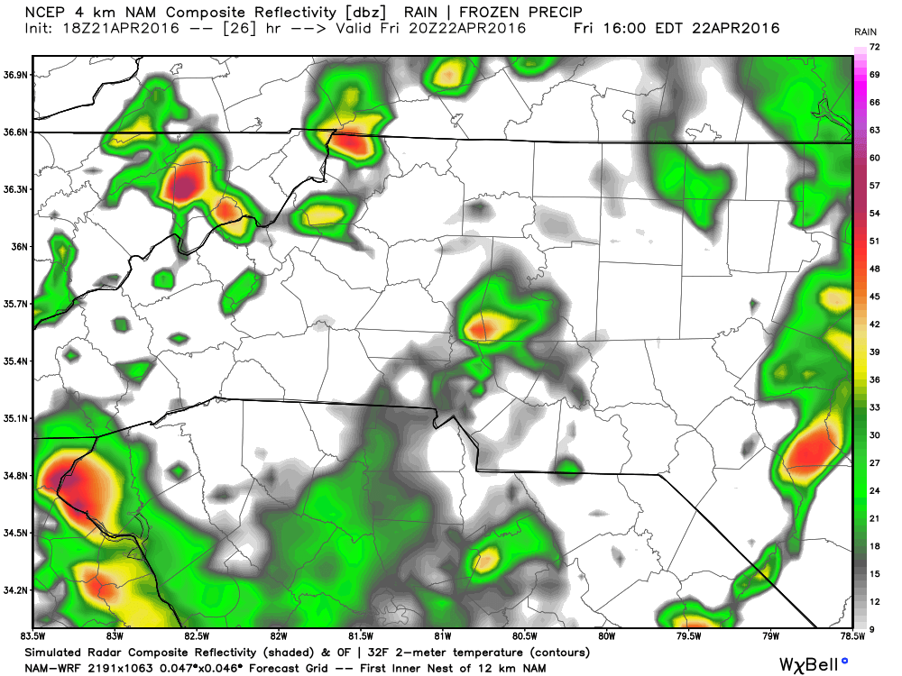
As we get into the afternoon hours the chance for some heavier rain and thunderstorms will be possible.
I think we could get one last push for a thunderstorm chance in the late afternoon hours tomorrow but that will be pretty slim in itself.
Accumulation chances are around a quarter to a half of an inch are possible.
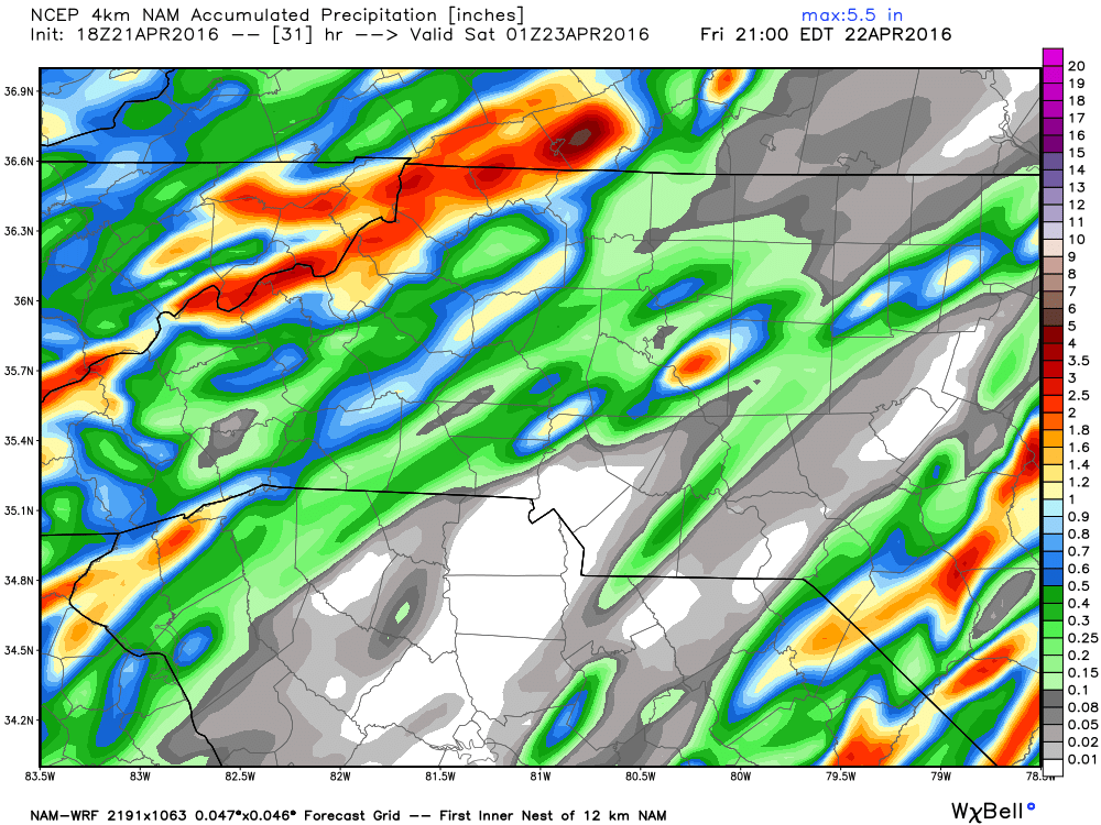
Now again I have to reiterate this is the only model run to this point that has been pushing for the amount of rains listed in this post.Up to this point I have only been forecasting around a quarter of an inch of rain being possible as most of the activity will be isolated. However, if this model run holds true those light showers and drizzle could give us the chance of around a half of an inch of accumulation with a thunderstorm passing through behind them.
We will have to see how it plays out. I will post another update later tonight on how things will possibly play out for tomorrow. As always thank you for following Rowan County Weather!