
What to expect today and Friday with the system moving in
As we get closer and closer to the potential for severe weather today and tomorrow. Let's take another look at what to expect. The good news is based on models and how they have been trending the localized flooding is becoming less of an issue. However, the potential for damaging winds during the morning hours tomorrow is still possible. Let's start with what to expect today.
Thursday
Rainfall should begin to move into the county with a few isolated showers occurring in the late afternoon and early evening. There will be a widespread are of rainfall that should move into the county around 7pm. There could be a few areas with moderate to heavy rainfall. Not looking for more than rain tonight.
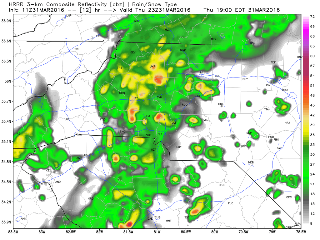
The CAPE or in laments terms Thunderstorm fuel for tonight is not to concerning but can't rule out some rumbles of thunder and flashes of lightning.

Wind gust tonight look to be rather minimal. The real concern for damaging winds will be Friday Morning.

As you can see from the potential rainfall totals through 8 pm tonight. Only about two tenths of an inch is expected around the county. This certainly reduces the localized flood threat.

Friday
I think the real meat and potatoes of this system moves in Friday morning and that's the period of time we need to focus on the strong to severe weather potential.
At 10 am Friday morning the models are indicating what appears to be an area of moderate to heavy rainfall and damaging winds that will be just to the west of the county.

As we start to take an hour by hour look at the models around 11 am my concern and area of focus will be triggered toward the southwestern areas of the county as the models are indicating possible hail chances for the areas in and around Enochville, China Grove, Landis & Kannapolis.
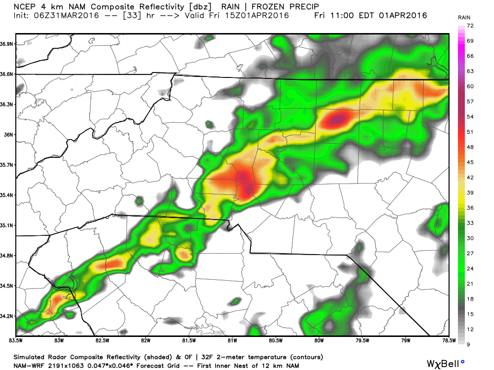
By around midday most of the heavy rainfall will be pushing its way through eastern Rowan County which will be the last real area of concern for those damaging winds.

As we head into the afternoon hours around 1 pm it appears the rainfall will be to our east and clearing will begin to occur.

I was contacted by someone in NASCAR earlier asking about the potential for practice and qualifying in Martinsville tomorrow. The practice at 11:30 in the morning certainly looks doubtful but the 4 pm qualifying certainly looks possible as the pressure would only be on the track drying teams to get the track ready.
What to prepare with?
With the threat being in the morning hours on Friday the good news would be that if you lose power. Hopefully it will only be temporary and you will not need flashlights. The only thing I would recommend is making sure batteries are charged in cell phones laptops and tablets. This will be useful in allowing you to keep up with the latest weather information. I would try to not to be on the roads during the mid morning hours as this would be the time the heaviest rainfall and potential damaging winds would occur.
I will post another blog update later today with the latest from the models and if the timing changes in anyway. As always thank you for following Rowan County Weather!