
Thursday Evening Weather Update
As the rainfall begins to move into the county I wanted to go ahead and post another update with the latest timeframe for the system that is moving through the county tonight and into the morning hours of the day tomorrow.
Tonight
Nothing to worry about tonight but rain. We could hear a few rumbles of thunder and a couple of flashes of lightning but nothing severe tonight.
Friday
The timing of this system continues to change ever so slightly. The system looks to be picking up speed and will come through a little earlier than first anticipated. I am changing the timeframe to a 5 am - 9 am window that we will need to monitor for severe weather. The only threat at this point is damaging winds but that threat is starting to dwindle down just a little. Still need to keep your guard up.
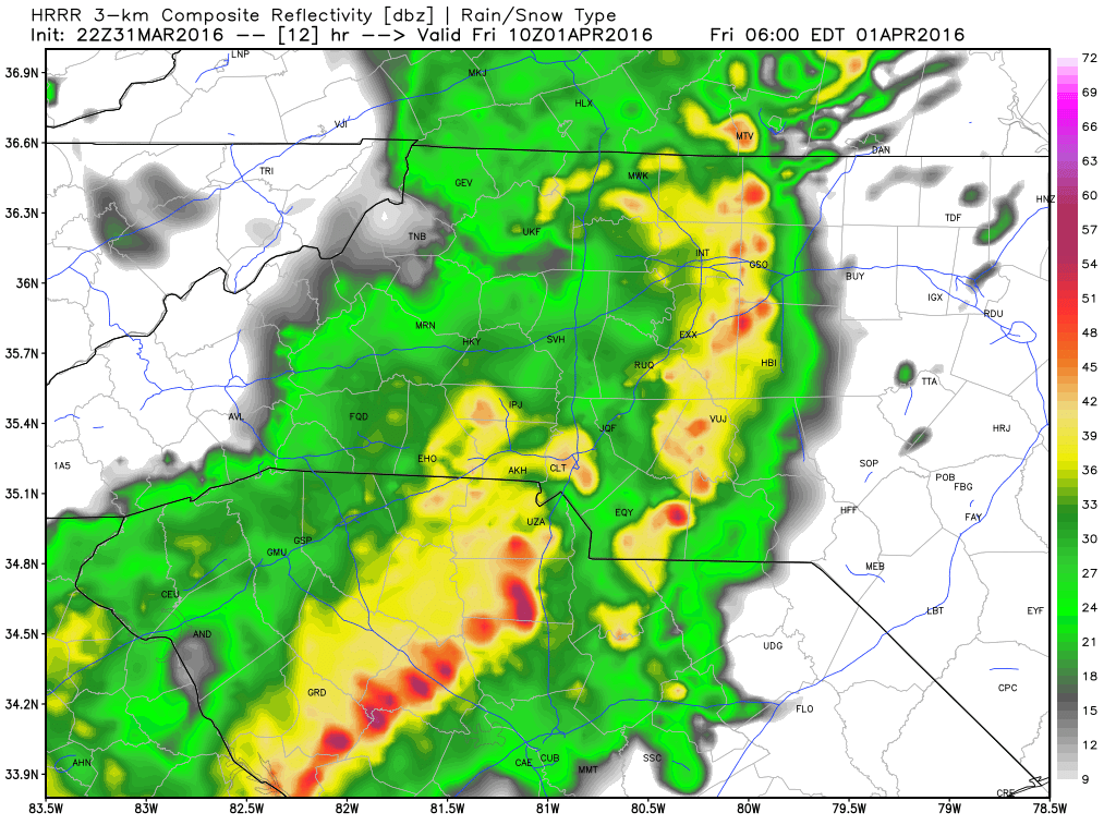
The model below is the short range model for 5 am Friday morning. You can see a strong line of storms entering the western areas of the county. This would be the line that could bring damaging winds with it.
morning. 
By 6 am the eastern areas of the county will be dealing with the potential for damaging winds with the line of storms moving through those areas of the county.
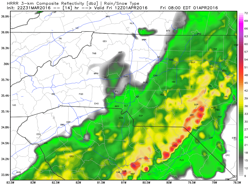
By 8 am we will start to see the back edge of the precipitation make its way out of the county.
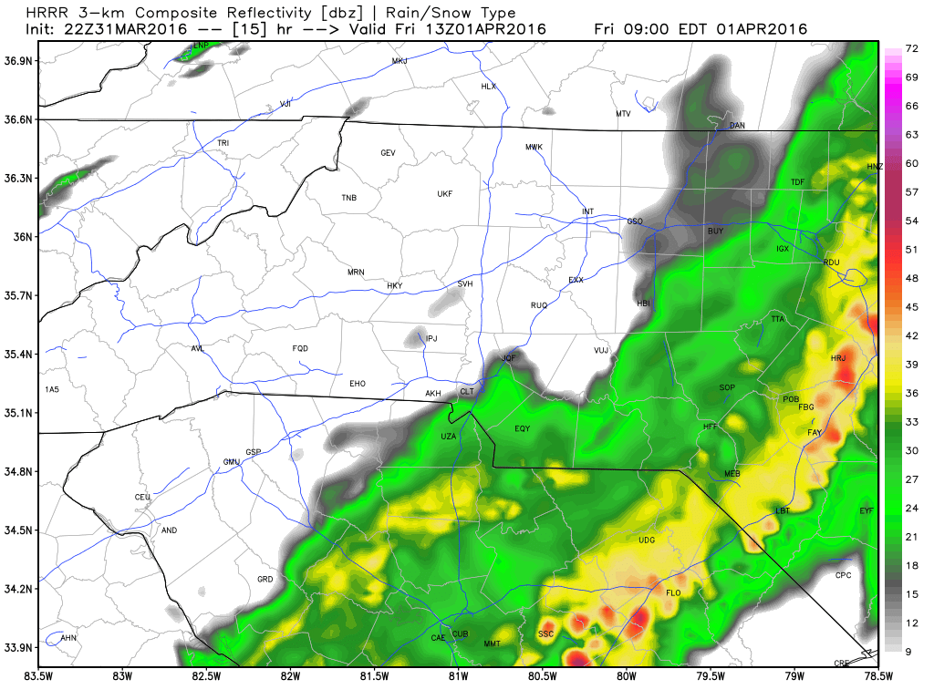
By 9 am I think we will be total clear of rainfall and Friday could turn out to be a really nice day overall.
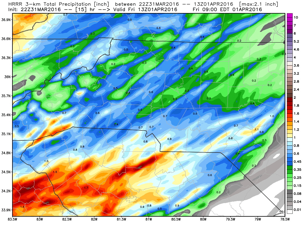
Not as much rainfall as originally anticipated as this system looks to zip through with its heaviest downpours in the morning. Total rainfall accumulation around the county could be as little as a quarter of an inch to around a half of an inch.
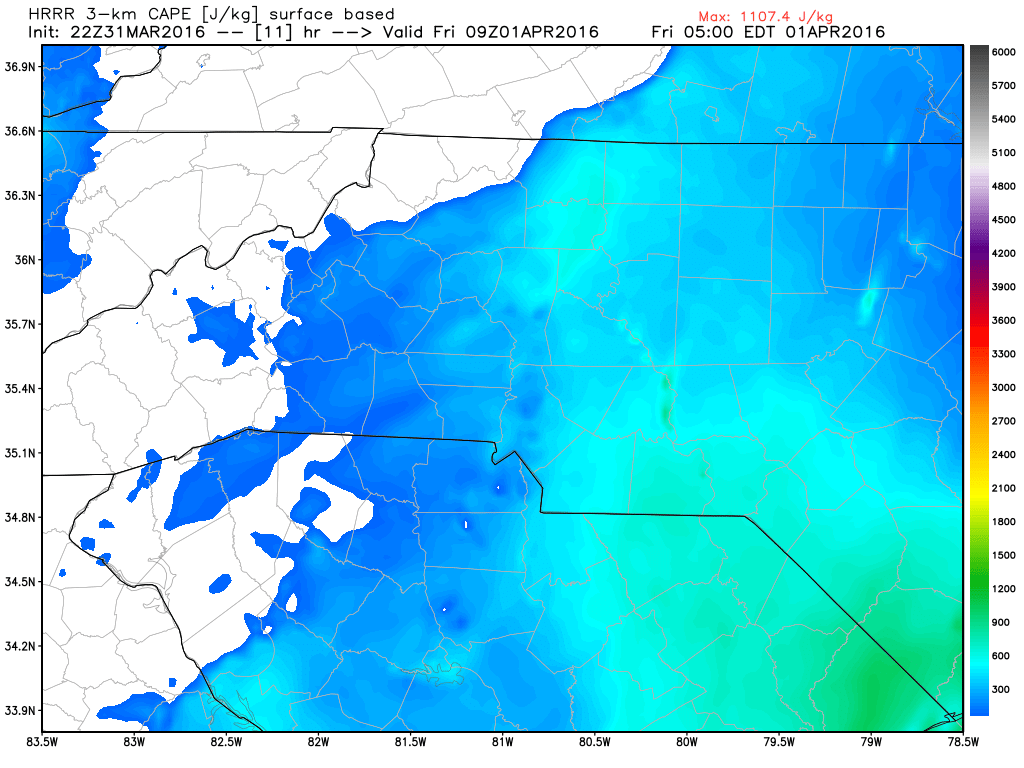
The one real promising factor I am seeing about tomorrow morning is the CAPE is not to bad. I think it's just high enough to cause the concern for damaging winds but not high enough to worry about any chance of a tornado in the county.
I will continue to monitor the conditions and post updates for this system. Thanks as always for following Rowan County Weather!