
Thursday Afternoon weather update
The timing for the weather system moving into the county is still tweaking itself just a little as the models continue to get a handle on this system. Not a lot has changed from this morning other than the timing.
Threats
The threat continues to be the potential for damaging winds tomorrow morning. Localized flooding is minimal but not likely at this point.
Timing
We could see showers move into the county during the evening commute tonight. Nothing much out of this system tonight other than rain.

As we turn our attention to the morning commute on Friday this is where I feel storms could become strong or even severe. I expect we will see a few areas of moderate to heavy rainfall during this time as well. Damaging winds the main concern.
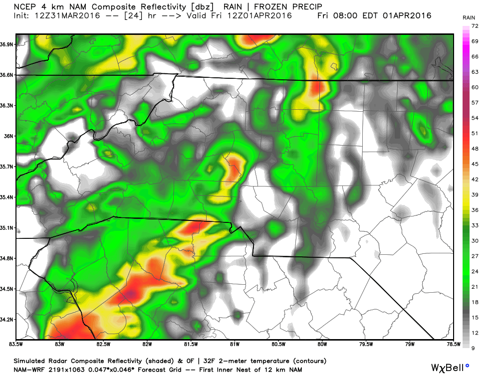
The line of storms that could bring the damaging winds will move through quickly once they arrive. Going to be a lot of wind pushing this part of the system through in the morning.
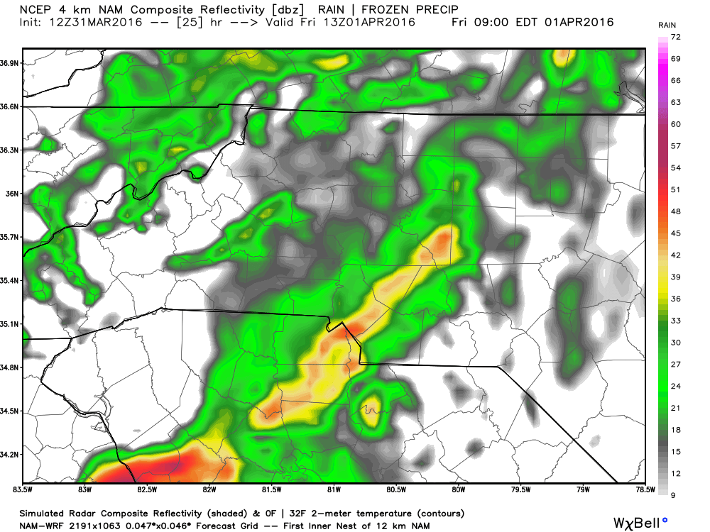
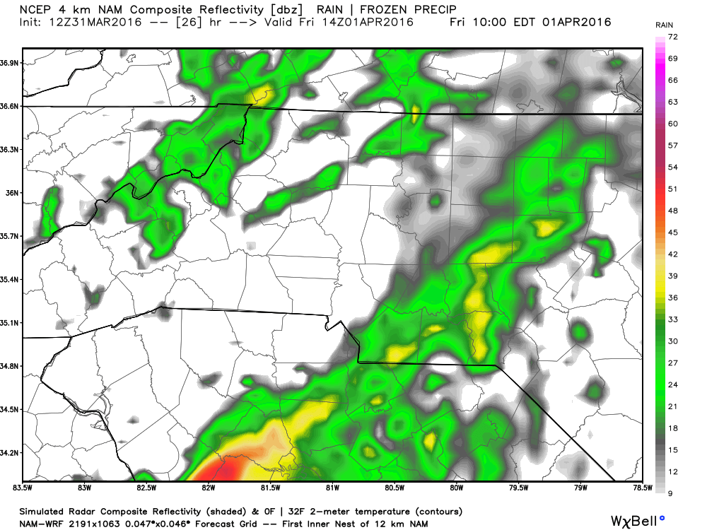
The good news is this system will be mostly to our east by around 10am in the morning. This will allow clearing to begin. Would not be surprised to see a few isolated showers after 10 am but most of the activity will have moved through by that point.
I will make another post later tonight as we get closer to the beginning of this event. The good news is the trends for the models have continued to show weakening in this system as it approaches the county. That is a trend I would like to see continue. As always thank you for following Rowan County Weather!
Please let our local sponsors know that you appreciate their support of our blog. Take a moment to visit their website linked at the top of this post.
Share this:

Announcements & Events
Check back often for important announcements and events that I'll be involved in!