
Thursday & Friday Weather Update
As we get closer and closer to Thursday and Friday's rain event we have coming many questions remain on what the threats may or may not be. I just wanted to make a quick blog post today with my latest thoughts. Before I dive into the details let me first just say I do not expect any potential for strong to sever storms until around midday on Friday. I also think the main threats at this point will be localized flooding. The only real change with that from my last update is the timing has slowed just a bit. Most of the rainfall appears to be coming in Friday morning and into the afternoon hours.
Let's take a look at the latest timeline I have for when rain will arrive and at what point I think the thunderstorm potential moves in.
We could see our first areas of isolated showers moving into the area just after midday on Thursday with most of the rain staying to our west in the mountains.

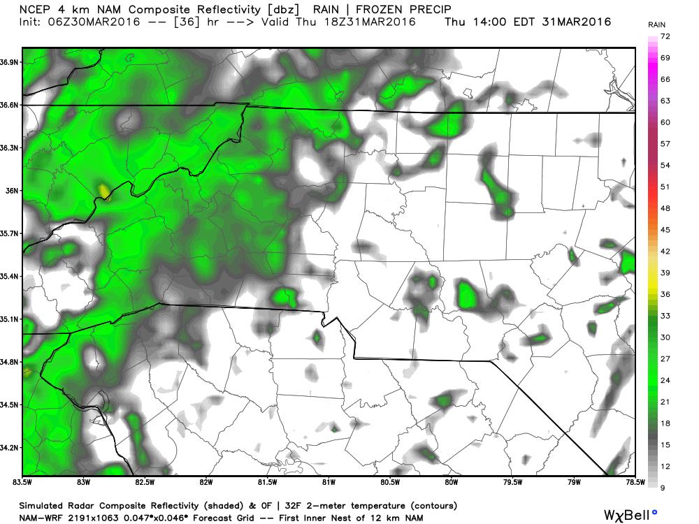
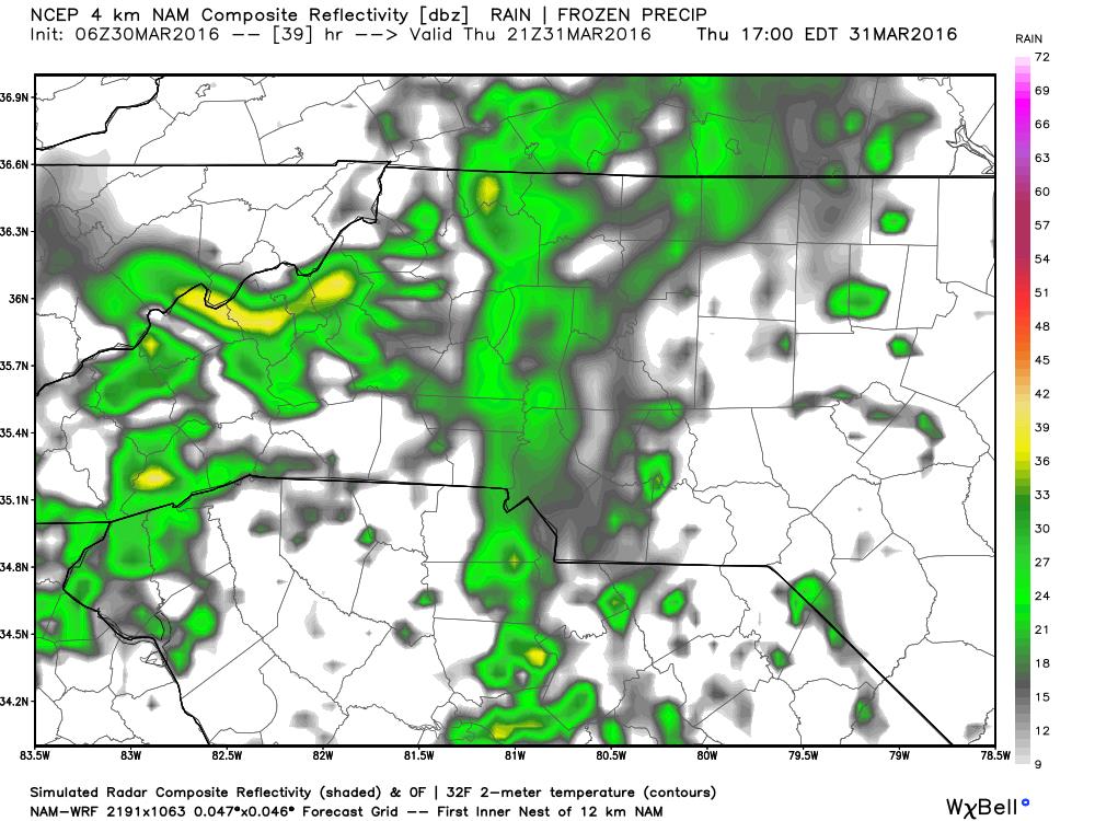
By the evening commute on Thursday it looks like we will be in the early stages of what will be just a wet miserable evening and overnight. Nothing in the way of thunderstorms at this point.

As we begin the overnight hours going into Friday morning we will probably see some breaks in the rain as energy begins to get robbed from the first wave of rainfall as it moves through the area.


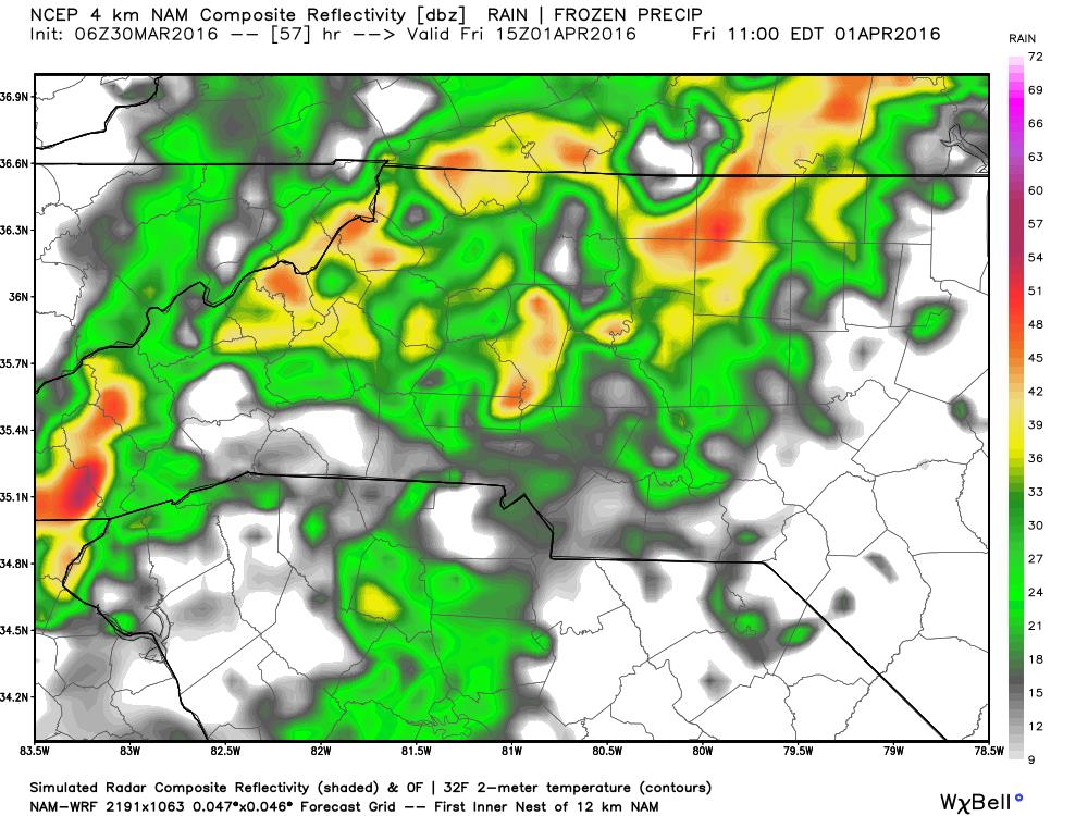
Then as the morning commute begins to take place on Friday Morning we will begin to see the beginning stages of the second line of showers and storms start to move in with the front.

I do expect that as we beginning to transition from the morning hours on Friday into midday we will see storms start to fire up along the front as they cross over the county. Between 11 am & 2 pm we could see a few strong thunderstorms. That will be the timeframe to watch closely. Not looking for anything in the way of a tornado this system does not have what's needed for the development of tornadoes. Could see some strong gusty winds during this time frame.
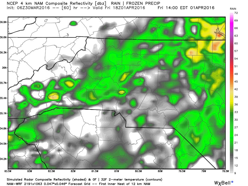
As we move into the afternoon and evening hours we will see the storm potential start to go down as the front makes its way through the area. rainfall will still be an issue as there is still quite a bi of much needed moisture with this system.
Total rainfall from the time this system begins to work its way into the area through 2pm Friday looks at anywhere from a tenth of an inch to over a half of an inch around the county.

By the time the system moves out on Friday evening I think we could see anywhere from an inch to an inch and a half of precipitation around the county.
For now threats appear to only be.
- localized flooding
- strong winds during the midday time frame on Friday
I will post another update later this evening and of course keep you updated as the weather begins to move into the area and closes in on the county. As always thank you for following Rowan County Weather!