
Rain returns early Friday Morning
Today has been absolutely perfect in terms of weather for the county. Things will start to change over the next 24-38 hours. We will see clouds and showers begin to move in. Not looking for much in the way of severe weather but a few storms as they pass through on Friday Morning could be a little strong. The timing as of right now looks to be between 5am-11am on Friday Morning. Lets take a look at three hours intervals of simulated radar from the North American Model.
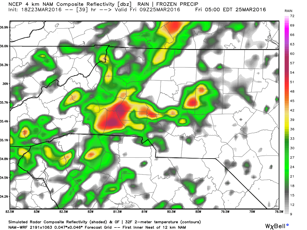
At around 5am Friday morning we could see moderate rainfall in the Southern areas of the county. Would not be surprised if we hear a few rumbles of thunder as well.

Ground level winds will be gusting at around 20mph per hour so nothing to worry about in terms of damaging winds.

Winds above ground level will only be gusting at around 25 mph. This will keep these storms from zipping through to fast so the good news with that will be much needed rainfall to wash away some of the pollen.
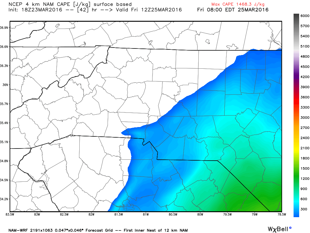
With the CAPE shifting east around 8am Friday Morning any potential storm we have out there will start to diminish pretty quickly as there will jus not be enough steam in the atmosphere at that point to keep these storms firing on all cylinders. Mainly a rain threat at this point and time Friday Morning.
 At
At
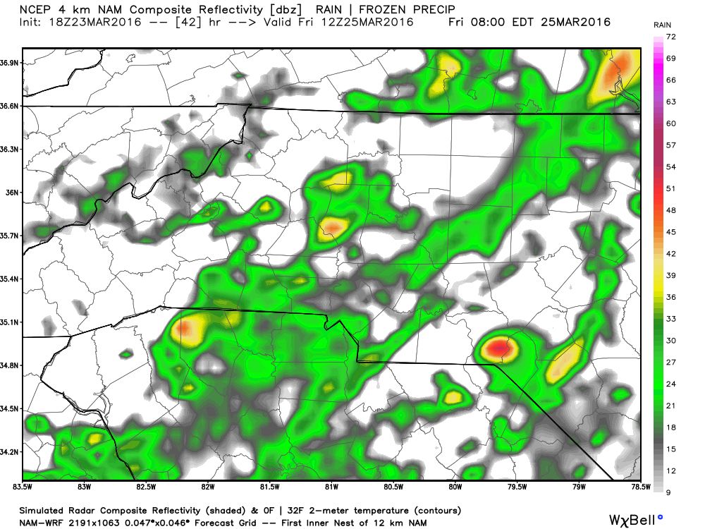
At around 8am Friday morning we will continue to see rainfall move through the area but these storms may be losing their punch around this time as well.

By 11am we should see rain start to move out to help us rebound for the afternoon and evening hours with a sunny day on Saturday.
Nothing severe to worry about at this point but I wouldn't be surprised for a few of the storms in the area to be a little strong and put down some decent rain in a short period of time.

By the time all is said and done we could see rainfall totals around the county between a quarter of an inch to just over an inch of rainfall. As of now the heavier rainfall looks to be in the Cleveland area along the 1-40 corridor.
I will continue to monitor the models and provide updates as we get closer to Friday Morning.
As always thank you for following Rowan County Weather!